How We Use Geography to Improve Children’s Health

From Hippocrates to John Snow, the father of epidemiology, even the earliest forms of public health recognized the complex connection between our health and the spaces in which we live. For children, their built environment – the physical spaces where they live and spend their time – sets them on a path that will influence the rest of their lives. This is why exploring neighborhoods and geographic environments is so important – we can provide children with better care and more opportunities for success if we understand how they are affected by their neighborhoods.
In recent years, new technology has greatly expanded our ability to explore the relationship between place and health, including here at Children’s Hospital of Philadelphia (CHOP). For example, Geographic Information Systems (GIS) tools have the power to reshape how we think about health in our communities by visualizing and measuring differences in health by location.
In celebration of GIS Day on November 15, we are highlighting a few of our projects that link geography, neighborhoods and children's health. While these studies differ quite a bit, they all make clear that examining where you live could be one of the best tools that public health practitioners have to set you on a path towards health.
Screening for food insecurity in primary care clinics
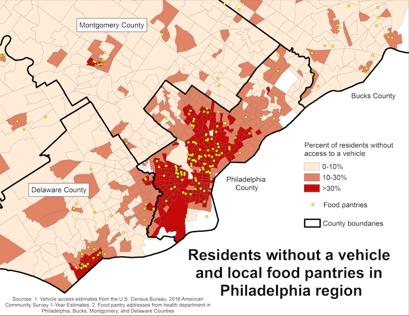
Food insecurity affects children’s physical and mental health in countless ways, but identifying it in primary care settings holds promise for helping families find new food resources. Former PolicyLab faculty member Dr. Deepak Palakshappa and team identified children screened for food insecurity at CHOP primary care practices and then used GIS to learn more about their environments. They discovered that food insecure children were less likely to have access to a car, which could limit their family’s ability to reach local food pantries. This research will help CHOP physicians provide useful information about local food resources to food insecure families.
[Tip: Click the maps for a larger version]
Local food pantries and Philadelphia neighborhoods’ vehicle access. Families without a vehicle may be unable to access to local food resources, such as food pantries.
Attention-deficit/hyperactivity disorder (ADHD) intervention and neighborhood-level mediators
Youth with ADHD often need many people in their lives involved in their care. PolicyLab researcher Dr. Jim Guevara is testing an intervention that facilitates communication between parents, clinicians and teachers in order to help children with ADHD succeed in school. GIS has allowed his team to examine how the success of this intervention might differ depending on the child’s neighborhood. Characteristics such as school performance, neighborhood income, or the number of nearby libraries could affect how well the intervention works for patients. Using this information, Dr. Guevara can ensure the intervention works, regardless of where the children live.
Kidney stones and water with high mineral content
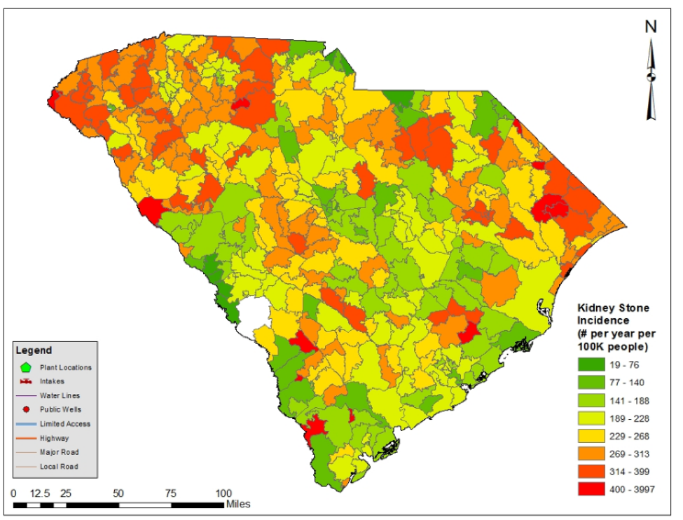
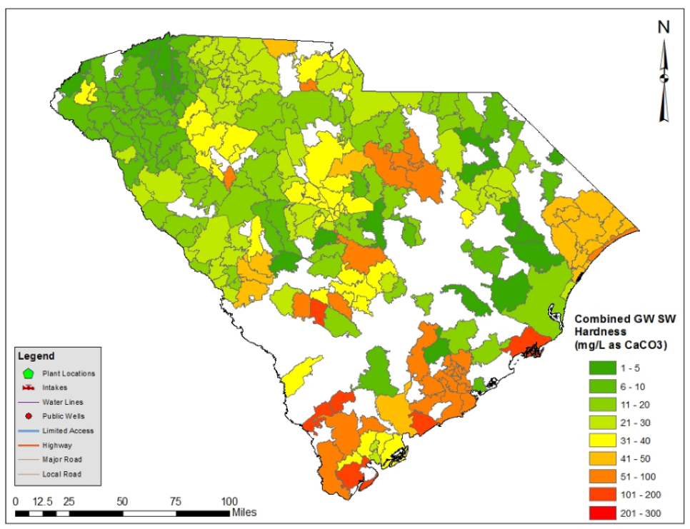
The prevalence of kidney stone disease in children has increased in recent decades and some believe that where children live might have something to do with it. Clinical Futures researcher Dr. Greg Tasian and his multidisciplinary team are using GIS to identify “hot-spots” of pediatric kidney stone disease in South Carolina and determining whether local environmental exposures, such as the mineral content of their drinking water, are associated with the disease. The findings from Dr. Tasian’s study could give doctors a new way to think about which children are at highest risk for developing kidney stone disease.
Kidney stone incidence for South Carolina by ZIP code, 1996-2015. Measured in number of kidney stones per 100,000 people per year.
Water hardness for ground and surface water across South Carolina by ZIP code
Mapping a brighter future
Whether children live on a dense West Philadelphia block or in rural South Carolina, we all intuitively know that these places matter to our health. What’s exciting is that thanks to GIS we now have the tools to easily and accurately measure where we spend time and the many ways it can affect our well-being. We are excited to continue building our geospatial research here at PolicyLab so we can continue to ensure healthy futures for children.
Heather Griffis, PhD, MS, is the director of the Department of Biomedical and Health Informatics’ Healthcare Analytics Unit at Children’s Hospital of Philadelphia.
Vicky Tam, MA, is a senior geographic information system analyst at the Department of Biomedical and Health Informatics’ Healthcare Analytics Unit at Children’s Hospital of Philadelphia.


